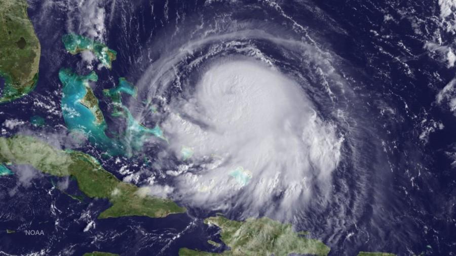
Hurricane Joaquin Making Landfall
IN SPACE – SEPTEMBER 30: In this handout from the National Oceanic and Atmospheric Administration (NOAA), Hurricane Joaquin is seen chruning in the Caribbean September 30, 2015. Joaquin was upgraded to a category 1 hurricane early on September 30. The exact track has yet to be determined, but there is a possibity of landfall in the U.S. anywhere from North Carolina to the Northeast. (Photo by NOAA via Getty Images)
October 14, 2015
As hurricane Joaquin strikes the Bahamas, concerns are growing in the U.S. over the potential of Joaquin hitting the East Coast. As of Wednesday morning, Joaquin is only a category 1 storm, with winds blowing at around 85 mph. However, it is expected to grow up to a category 3 by the time it reaches the U.S. While it’s not for certain, the chances are high that Joaquin will hit the East Coast, so state officials are preparing for the worst the storm has to offer. No matter its path, most States on the East Coast can expect up to 12 inches of heavy rainfall.
The people of New Jersey certainly remember hurricane Sandy a few years ago, as many homes on the Jersey Shore still lie in shambles. With the possibility of the storm landing anywhere between Northern Florida and Southern New Jersey, those affected by Sandy have some worries about the impact that Joaquin will cause. Joaquin’s threat as of now seems to lie in the heavy rains the storm will bring with it, contrary to Sandy’s devastating storm surge. However, if Joaquin should make landfall, the potential of a storm surge greatly increases. While many people are on edge, some have a brighter outlook on the storm. “I didn’t know it was going on, but now I’m excited. I hope school is cancelled.” said Wayne Hills junior Julia Fields.
Meteorologists are largely unsure of the exact path Joaquin will take, so the only thing that will indicate a clearer path is more time.


